Public Map Platform icon
Home Map Base Maps Layers Themes Atlas Symbols Media Events Training
English Cymraeg
My Profile Change Password
Home Map Base Maps Layers Themes Atlas Symbols Media Events Training
English Cymraeg

Projects by Scott Orford

Project image

Northern Ireland Plastics Recycling Ecosystem

Scott Orford
0
0
Project image

Llangefni Physical Asset Map

Map of different physical assets in central Llangefni added to OpenStreetMap

Scott Orford
0
0
Project image

Crime on Anglesey

OpenStreetMap is created with crowdsourced data for detailed urban exploration, aiding in route planning, location identification, and community contributions. Users benefit from up-to-date information on roads, businesses, landmarks, and amenities, making it a versatile and reliable basemap layer.

Scott Orford
0
0
Project image

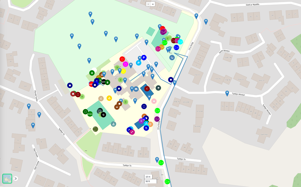
Ysgol y Borth Social, Cultural and Environmental Mapping

A variety of maps map by school children from Ysgol y Borth. These include social maps of the area around the school, cultural maps of local places and environmental bio-diversity mapping of the school grounds.

Scott Orford
0
0
Project image

Medical and Dental Practices on Anglesey

A map of the locations of cosmetic services, dental practices, GP surgeries, hospices and hospitals on Anglesey. Based on Health Care Inspectorate Wales data

Scott Orford
0
0
Project image

Places affected by storm damage and areas at risk of flooding

National Resources Wales National Flood Risk Maps for Anglesey with crowd-sourced mapping of damage from the winter storms of 2024 -2025

Scott Orford
0
0